2025 Hypoxia Monitoring Results Featured in Press Releases and Media Event
August 1, 2025
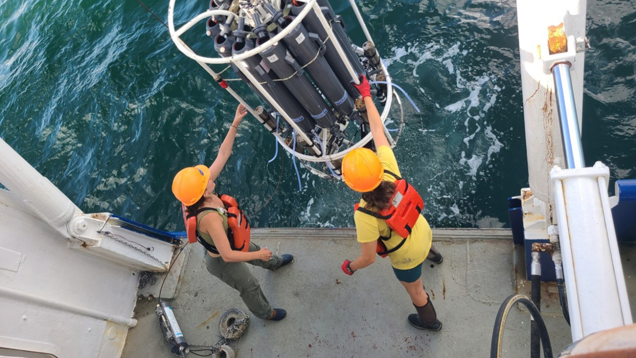
Dr. Jill Tupitza and doctoral student Allison Noble deploy Niskin bottles and instruments to collect near-bottom water aboard the RV Pelican to obtain oxygen measurements used to determine the size of the Gulf of America hypoxic zone. (Image credit: Louisiana State University, Cassandra Glaspie)
Scientists completed and published results from their 2025 annual survey expedition that monitors hypoxia or low oxygen in the northern Gulf of America adjacent to the Mississippi River. The National Oceanic and Atmospheric Administration (NOAA) and the Northern Gulf Institute (NGI) provide support for this annual survey cruise, which sails out of the Louisiana Universities Marine Consortium (LUMCON) facility in Cocodrie, LA.
Press releases summarizing this year's annual hypoxia monitoring results for the Gulf of America include:
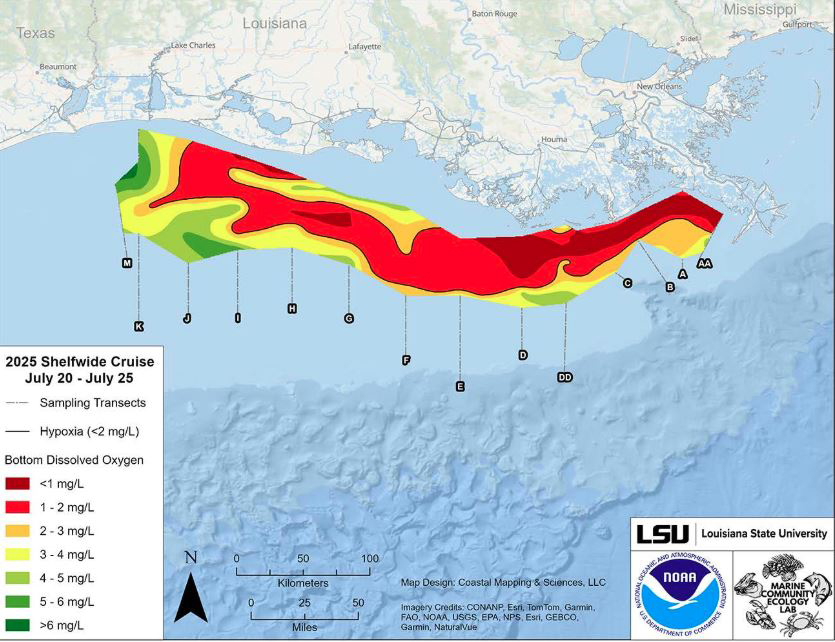
NOAA 2025 Hypoxia Announcement says the hypoxic "dead zone" is approximately 4,402 square miles, 21% smaller than estimates from early June. The area represents potentially unavailable habitat for fish and bottom organisms.
LUMCON 2025 Hypoxia Forecast is based on a survey conducted on July 20–25 aboard the RV Pelican that provides a key metric for the Hypoxia Task Force, whose long-term goal is to reduce the five-year average extent of the dead zone to fewer than 1,900 square miles by 2035.
On July 31, 2025, NGI hosted a media event titled "The Measured Size of the Gulf of America Dead Zone and Efforts to Predict and Mitigate its Effects" that included summaries and explanations by experts and stakeholders followed by a Q&A session with representatives from the press. NGI Co-Director Dr. Paul Mickle moderated the discussion among this panel of experts:
An audio recording of this one-hour media event is available here:
Map of measured Gulf hypoxia zone, July 20 - 25, 2025. Red area denotes 2 mg/L of oxygen or lower, the level which is considered hypoxic, at the bottom of the seafloor. Image credit: NOAA/LUMCON/LSU
Monitoring the Gulf of America hypoxic zone helps advance the science that underpins its management by scientists, modelers, resource managers, and other stakeholders. Data from the annual expeditions help measure progress toward achieving nutrient management goals set forth in the Gulf Hypoxia Action Plan and are incorporated into biogeochemical and hydrodynamic models for forecasts and hindcasts.
************
The Northern Gulf Institute is a NOAA Cooperative Institute with six academic institutions located across the US Gulf Coast states, conducting research and outreach on the interconnections among Gulf of America ecosystems for informed decision making.