Study Finds Existing and Planted Shoreline Vegetation Respond Differently to Breakwater Protection
March 4, 2022
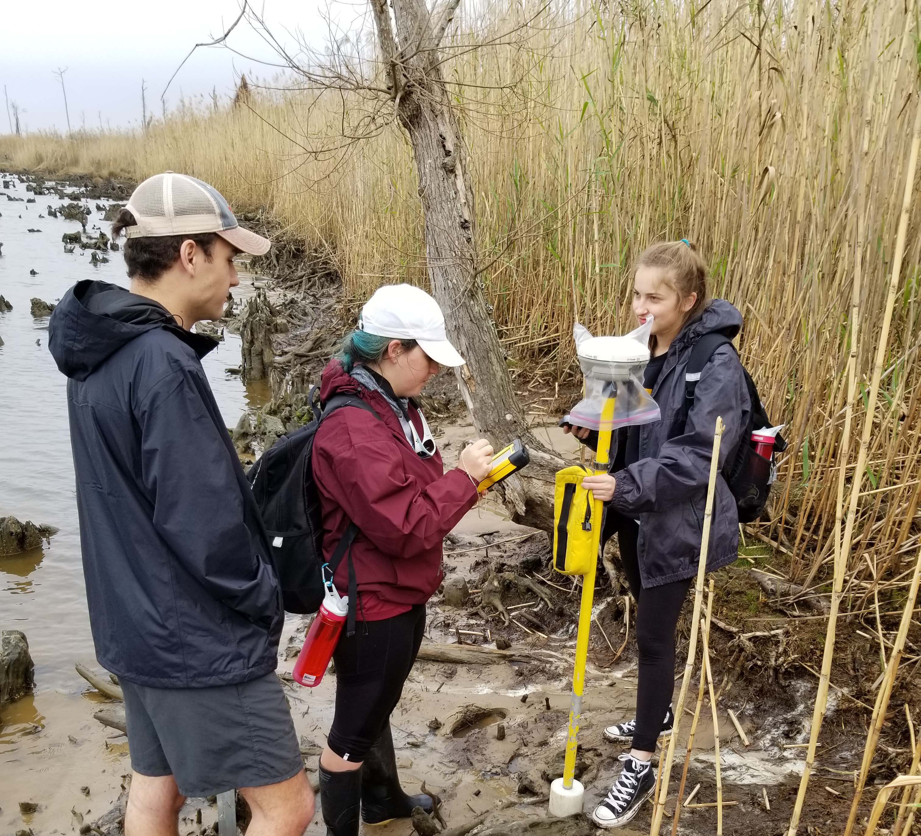
L to R: Matt Virden, Sara Martin, Alyssa Rodolfich. The Mississippi State
University (MSU) research team uses a real-time kinematic (RTK) unit to
measure expansion and migration of shoreline vegetation patches at the
Swift Tract study site in Bon Secour Bay, Alabama. Photo by Eric
Sparks, MSU Coastal Conservation & Restoration Program.
Shoreline erosion and wetlands loss are critical issues along Gulf of Mexico coastlines. Living shoreline designs that incorporate large-scale breakwaters are increasingly used to protect vulnerable areas.
To understand the effectiveness of a breakwater system on existing vegetation and on plantings that are often included in these projects, researchers monitored shoreline change following the installation of breakwaters along Bon Secour Bay, Alabama for three years.
Their findings indicate that near-shore breakwaters are more effective at conserving existing marsh than creating new marsh. The study
The effects of large-scale breakwaters on shoreline vegetation was published in Ecological Engineering in November 2021.
In recent years, numerous large-scale living shoreline projects have incorporated nearshore breakwaters along the northern Gulf of Mexico, with many being installed in response to the 2010 Deepwater Horizon oil spill. However, not much is known about their effectiveness at preserving natural shorelines and promoting the growth of shoreline plantings.
To address this gap, the research team monitored an area that included both natural shoreline vegetation and shoreline plantings of Spartina alterniflora along a breakwater-protected area and an adjacent area with no breakwater protection. They measured the expansion and upland migration of the shoreline vegetation using drone imagery, which created base maps of the shoreline, and using real-time kinematic (RTK) GPS units, which measured the perimeter of shoreline vegetation patches. After laying the outlines over the drone images, they used GIS software to determine the movement of vegetation patches in response to nearshore breakwater protection.
For naturally established vegetation, the results showed that the breakwaters successfully provided stabilization.
"It showed that breakwaters do protect and enhance natural shoreline vegetation and also allow for the vegetation to expand seaward towards the breakwaters," said study author Sara Martin. However, the results were different for the planted vegetation, "Even when protected by breakwaters, planted vegetation only had about 30% cover after three years whereas the natural vegetation maintained 70% cover. The nearshore breakwaters only slightly reduced the wave energy that reached the shoreline, and the planting in this high wave energy environment had low levels of success."
The authors raise concerns about the longer-term picture, including sea-level rise that could submerge breakwaters, making them not perform as intended. Martin explained, "Nearshore breakwaters will need to be adaptively managed as sea levels rise, so their installation may not be appropriate in all circumstances."
Long-term monitoring of these projects would provide a more comprehensive understanding about the effect that large-scale breakwaters have on the shoreline vegetative community and on the marsh system as a whole.
The study's authors are Sara Martin, Nigel Temple, Gillian Palino, Just Cebrian, and Eric Sparks.
This work was supported by the NOAA NERRS Science Collaborative Program [Grant NA14NOS4190145], the Office of Sea Grant, and the Mississippi-Alabama Sea Grant Consortium [Grant NA10OAR4170078].
By
Nilde Maggie Dannreuther, Northern Gulf Institute, Mississippi State University
Sara Martin, Extension Associate, Coastal Research & Extension Center, Mississippi State University
