
collates microplastic data from across the globe to create maps and models to better understand their distribution and transportation across oceans, giving scientists and researchers a better understanding of microplastic’s impacts on human and marine health and the economy.
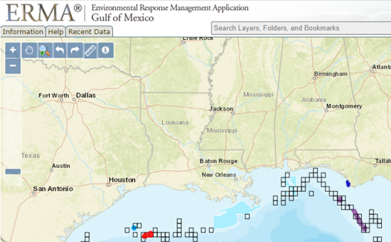
integrates and synthesizes various real-time and static datasets into a single interactive map for fast visualization of situations that may adversely impact the environment and improves communication and coordination among responders and environmental stakeholders.
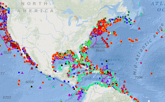
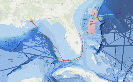
compiles the known locations of deep-sea corals and sponges in U.S. territorial waters and beyond. The comprehensive database is standardized, quality controlled, and networked to outside resources.
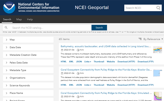
provides a search tool for datasets on seafloor mapping, waterborne pathogens, socioeconomic impacts on marine resources, fisheries, coral reefs, sea level rise, seabirds, water quality, benthic habitats, and more.
tracks the operations of the Okeanos Explorer in near real time, and shares the ship's current location, the current cruise’s ship track, and daily bathymetric products.
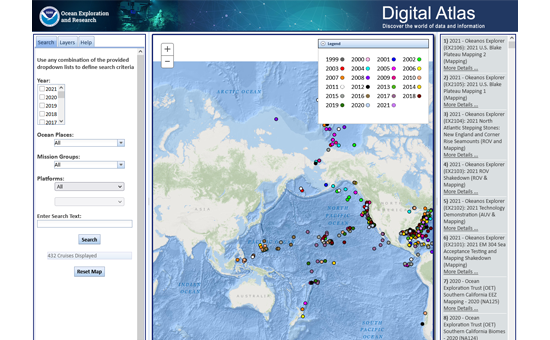
Digital Atlas is an interactive map that provides access to an updated archive of the NOAA Office of Ocean Exploration and Research (OER) data, information, and products including sonar, oceanographic, imagery, video, and collected specimen information that contribute greatly to scientific understanding of the world’s ocean.
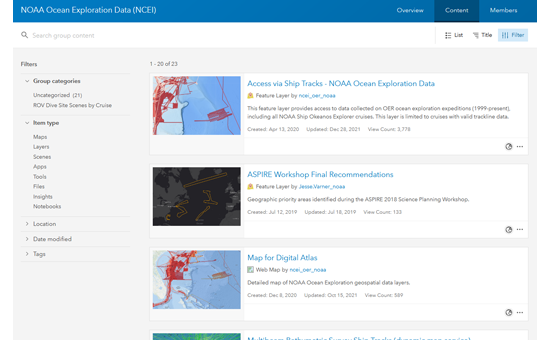
provides access to NCEI-managed OER geospatial data products to promote discovery, access, and reuse of ocean exploration data. This group includes data layers found within the Okeanos Explorer Live Operations Map and more.
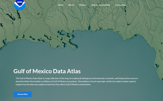
offers a map collection of the long-term physical, biological, environmental, economic, and living marine resource data that define the baseline conditions of Gulf of Mexico ecosystems. Descriptions of each map topic, written by subject matter experts, explain how the data were gathered and how they affect Gulf of Mexico communities.
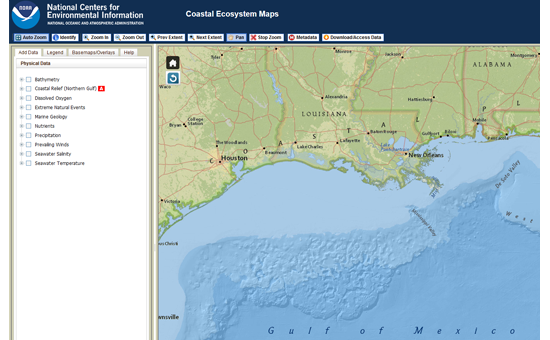
Coastal Ecosystem Maps integrate layers from the Gulf of Mexico Data Atlas into a single environment that allows users to select and view datasets individually or simultaneously. Additional data layers include model data such as sea surface currents, overlays for bathymetry, location names and other contextual information.
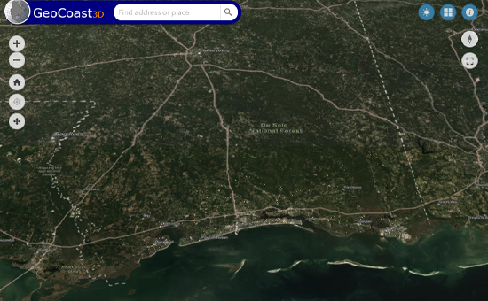
provides local and state decisionmakers as well as the coastal residents with a three-dimensional view of coastal flooding to examine the impact of rising water on infrastructure and traffic routes.
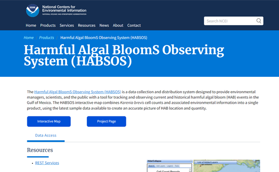
provides mapping tools to track and observe current and historical harmful algal bloom events in the Gulf of Mexico. It represents the largest data set of Karenia brevis (toxic alga) concentrations in the region.
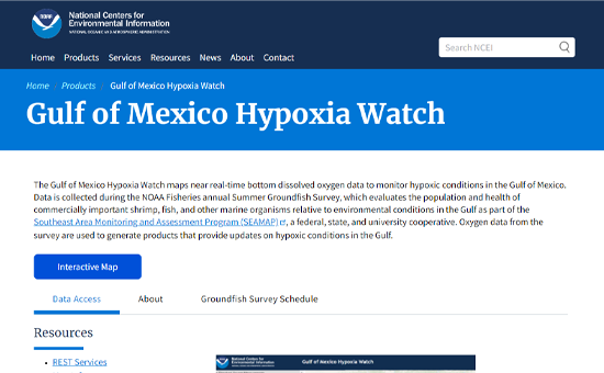
provides maps of near real-time bottom dissolved oxygen data to monitor hypoxic conditions in the Gulf of Mexico. Data is collected during the NOAA Fisheries annual Summer Groundfish Survey as part of the Southeast Area Monitoring and Assessment Program (SEAMAP).
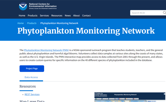
provides access to data collected from 2001 through the present and allows users to create custom queries for specific information on the 40 different species of phytoplankton included in the database.
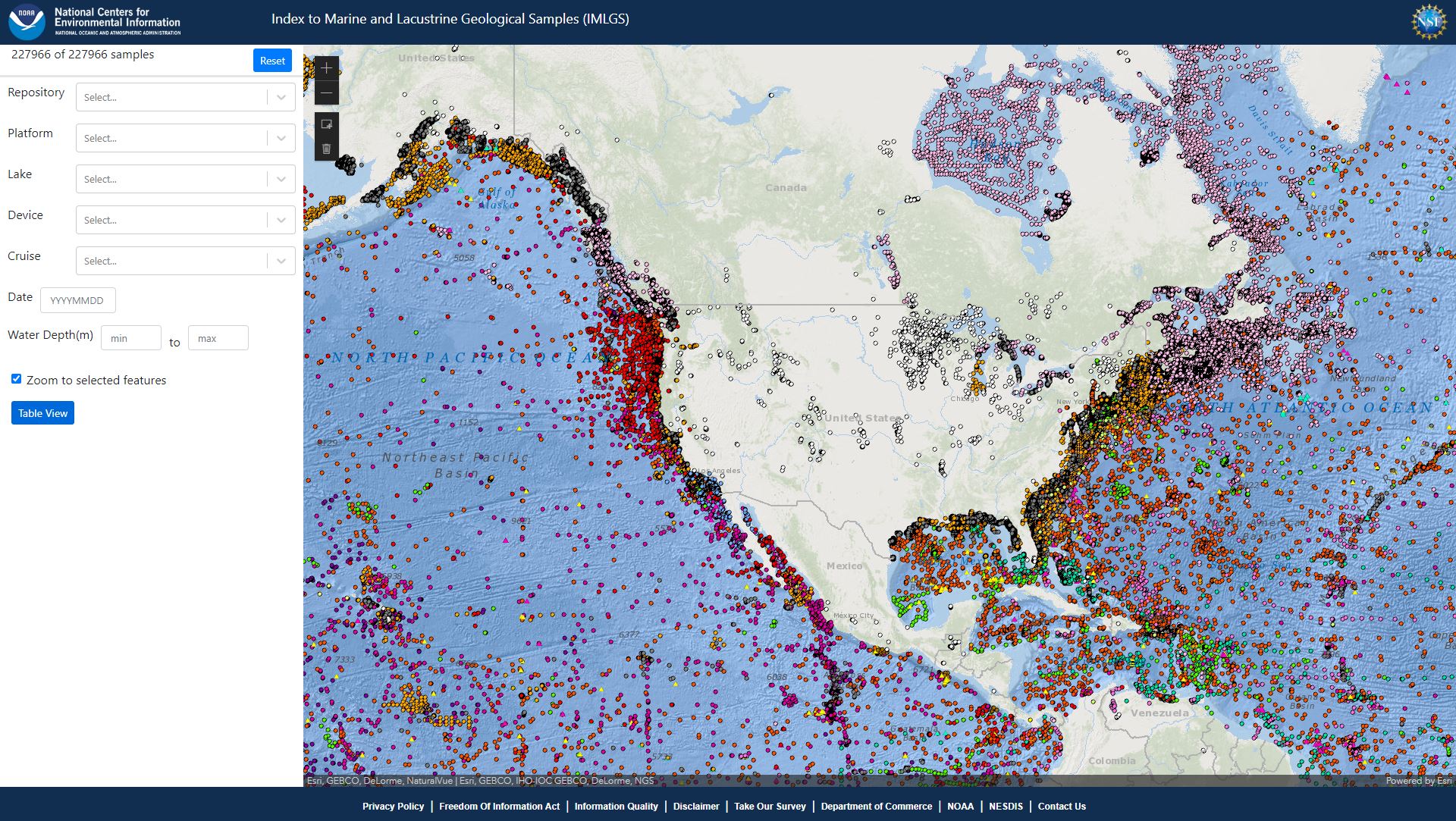
(IMLGS) is a database and web application that enables researchers to discover, learn about, and access geological data acquired from across the world's seabed and lakebed environments. Data access includes the digital data maintained at NCEI as well as the physical samples curated at national and international partner repositories.